


Perry Township Voting District, Woodson County, Kansas
About
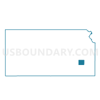
Outline

Summary
| Unique Area Identifier | 587646 |
| Name | Perry Township Voting District |
| County | Woodson County |
| State | Kansas |
| Area (square miles) | 48.92 |
| Land Area (square miles) | 48.71 |
| Water Area (square miles) | 0.21 |
| % of Land Area | 99.57 |
| % of Water Area | 0.43 |
| Latitude of the Internal Point | 37.78429590 |
| Longtitude of the Internal Point | -95.59008030 |
Maps


Graphs
Select a template below for downloading or customizing gragh for Perry Township Voting District, Woodson County, Kansas


Neighbors
Neighoring Voting District (by Name) Neighboring Voting District on the Map
- Center Township Voting District, Woodson County, KS
- Colfax Township Voting District, Wilson County, KS
- Logan Township Voting District, Allen County, KS
- North Tioga Township Voting District, Neosho County, KS
- Piqua Township Voting District, Woodson County, KS
Top 10 Neighboring County Subdivision (by Population) Neighboring County Subdivision on the Map
- Tioga township, Neosho County, KS (885)
- Center township, Woodson County, KS (527)
- Neosho Falls township, Woodson County, KS (457)
- Colfax township, Wilson County, KS (403)
- Logan township, Allen County, KS (219)
- Perry township, Woodson County, KS (104)
Top 10 Neighboring Unified School District (by Population) Neighboring Unified School District on the Map
- Chanute Public Schools Unified School District 413, KS (10,976)
- Humboldt Unified School District 258, KS (2,831)
- Woodson Unified School District 366, KS (2,747)
- Altoona-Midway Unified School District 387, KS (1,663)
Top 10 Neighboring State Legislative District Lower Chamber (by Population) Neighboring State Legislative District Lower Chamber on the Map
- State House District 9, KS (21,122)
- State House District 8, KS (20,232)
- State House District 13, KS (17,996)
Top 10 Neighboring State Legislative District Upper Chamber (by Population) Neighboring State Legislative District Upper Chamber on the Map
Top 10 Neighboring 111th Congressional District (by Population) Neighboring 111th Congressional District on the Map
Top 10 Neighboring Census Tract (by Population) Neighboring Census Tract on the Map
- Census Tract 9530, Allen County, KS (2,820)
- Census Tract 9517, Neosho County, KS (2,685)
- Census Tract 971, Wilson County, KS (2,084)
- Census Tract 966, Woodson County, KS (1,720)